|
Terry & Diana's
|
HOME - OUR PROPERTY - FAMILY - SCENERY AND TRIPS - PLANTS - CACTUS - DRAGONFLIES & DAMSELFLIES - BUTTERFLIES -AMPHIBIANS - REPTILES - BIRDS - MAMMALS |
Arizona September 2020
September 7
After attending our granddaughter's wedding near Boerne, we came back to Camp Wood Hills and were on the road by 2:30 PM. Our first stop was at Davis Mountains State Park for the night.
September 8
The propane sensor woke us at 5:15 AM and we couldn't get it to go off. I decided to cut the live wire so we could get back to sleep. I got up at 7:30 AM and tried to reattach the wire to sensor so inside camp lights would work. The fuse was blown. I could not find my extra fuses. We went on anyway. We ate breakfast and broke camp and headed west by 9:30 AM.
We stopped in Anthony at Camping World to get propane sensor. (Actually I found out later this wasn't the problem)
Decided to stop at the Rio Grande off of Vinton Road to check for Brimstone Clubtails. It was already too hot to find much. Stopped at Whataburger in Los Cruses, New Mexico to eat lunch before heading on west. We arrived at Luna Lake campground east of Alpine, Arizona at about dark. It rained or drizzled from about 8 to 10 PM. We had more trouble with the propane sensor.

Wilson's Warbler, TX: El Paso County, Viton Rd. and Rio Grande.

Blue-ringed Dancer, TX: El Paso County, Viton Rd. and Rio Grande.
.jpg)
Powdered Dancer, TX: El Paso County, Viton Rd. and Rio Grande.
.jpg)
American Rubyspot, TX: El Paso County, Viton Rd. and Rio Grande.
.jpg)
Roseate Skimmer, TX: El Paso County, Viton Rd. and Rio Grande.
.jpg)
Variegated Meadowhawk, TX: El Paso County, Viton Rd. and Rio Grande.
September 9
Got up about 7 AM and ate breakfast and changed out the sensor, but it still didn't work. We went into Alpine and found out the camper battery was dead. After buying a new battery, everything worked with no more "sensor" problems. So, we headed down to the Blue River south of Alpine at about 11 AM. We checked out a few sites along the Upper Blue River for camp sites. Saw a few birds and odes along the river. We then went back up to the Upper Blue River campground and picked a site. No one else was camping in the campground. The only traffic was a few locals going to and from their properties.

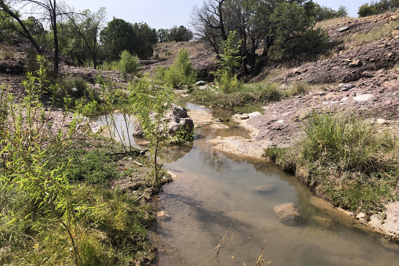
AZ: Greenlee County, Upper Blue River

AZ: Greenlee County, Upper Blue River

AZ: Greenlee County, Upper Blue River

AZ: Greenlee County, Upper Blue River
AZ: Greenlee County, Upper Blue River
Tree Lizard. AZ: Greenlee County, Upper Blue River
.jpg)
Chihuahuan Whiptail. AZ: Greenlee County, Upper Blue River
.jpg)
Prairie Lizard. AZ: Greenlee County, Upper Blue River

Lazuli Bunting. AZ: Greenlee County, Upper Blue River
.jpg)
Painted Redstart. AZ: Greenlee County, Upper Blue River

Western Tanager. AZ: Greenlee County, Upper Blue River

Plains Forktail. AZ: Greenlee County, Upper Blue River
.jpg)
Springwater Dancer. AZ: Greenlee County, Upper Blue River
.jpg)
Western Tiger Beetle. AZ: Greenlee County, Upper Blue River
.jpg)
Gyrocheilus patrobas. AZ: Greenlee County, Upper Blue River
September 10
I got up about 7 AM. It was way too cold to search for odes yet, so bird watched and got some photos. The odes did not start flying until about noon.
.jpg)
AZ: Greenlee County, Upper Blue River
.jpg)
Abert's Squirrel. AZ: Greenlee County, Upper Blue River
.jpg)
Steller's Jay. AZ: Greenlee County, Upper Blue River
.jpg)
Yellow-breasted Chat. AZ: Greenlee County, Upper Blue River
.jpg)
AZ: Greenlee County, Upper Blue River
.jpg)
Green-tailed Towhee. AZ: Greenlee County, Upper Blue River
.jpg)
Wilson's Warbler. AZ: Greenlee County, Upper Blue River
.jpg)
Black-headed Grosbeak. AZ: Greenlee County, Upper Blue River
.jpg)
Chipping Sparrow. AZ: Greenlee County, Upper Blue River

Arizona Sister. AZ: Greenlee County, Upper Blue River
.jpg)
Gyrocheilus patrobas. AZ: Greenlee County, Upper Blue River
.jpg)
Chihuahuan Spotted Whiptail. AZ: Greenlee County, Upper Blue River
.jpg)
Arizona Toad. AZ: Greenlee County, Upper Blue River
.jpg)
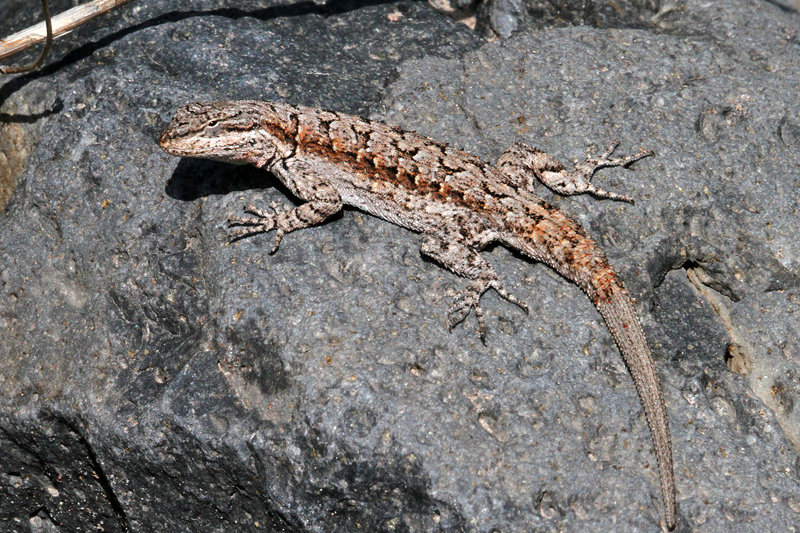
Southwestern Spiny Lizard. AZ: Greenlee County, Upper Blue River
.jpg)
Canyon Rubyspot. AZ: Greenlee County, Upper Blue River
.jpg)
Springwater Dancer. AZ: Greenlee County, Upper Blue River
.jpg)
Painted Damsel. AZ: Greenlee County, Upper Blue River
.jpg)
Sooty Dancer. AZ: Greenlee County, Upper Blue River
At 3 PM we packed up and headed over to Buffalo Crossing campground on the East Fork of the Black River. Arrived about 5:30 PM and picked camp site #4. I hoped it warm up enough for some ode movement tomorrow.
.jpg)
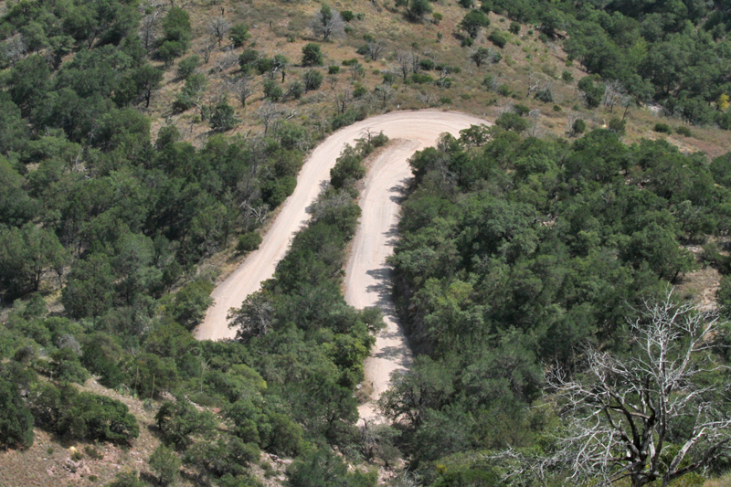
The road west out of the canyon. AZ: Greenlee County, Upper Blue River
.jpg)
The road west out of the canyon. AZ: Greenlee County, Upper Blue River
.jpg)
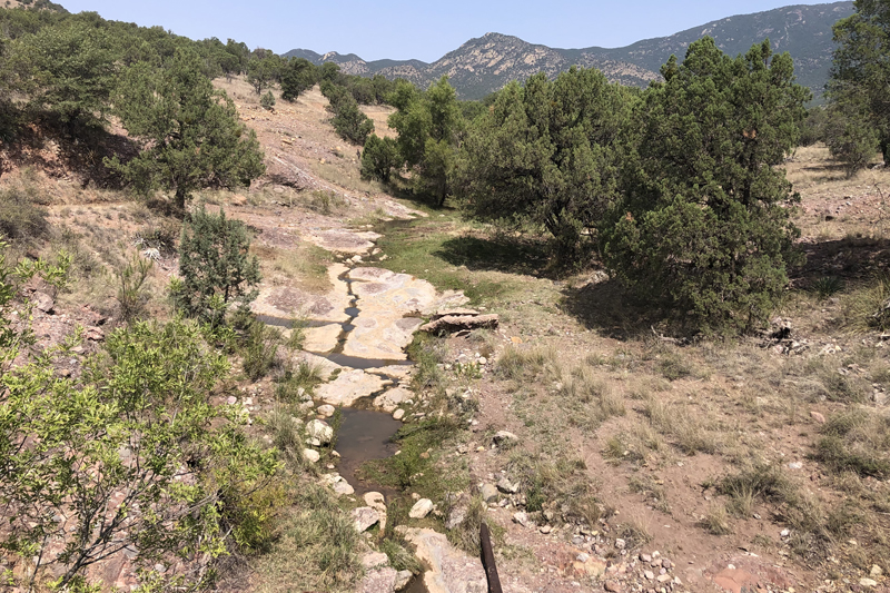
AZ: Greenlee County, Apache National Forest, Buffalo Crossing campground on the Black River. A good looking place.
September 11
Cold night with frost in places. The pickup was 47 at 8 AM. It was hard to get up. I bird watched and tried to photograph as many as I could. The sun was dim (low cover of clouds and smoke from distant fires or something. Very little bird sounds from the trees around us.
.jpg)
AZ: Greenlee County, Apache National Forest, Buffalo Crossing campground on the Black River.
.jpg)
Beaver dam. AZ: Greenlee County, Apache National Forest, Buffalo Crossing campground on the Black River.
.jpg)
Chipping Sparrow. AZ: Greenlee County, Apache National Forest, Buffalo Crossing on the Black River.
.jpg)
Dark-eyed Junco. AZ: Greenlee County, Apache National Forest, Buffalo Crossing on the Black River.
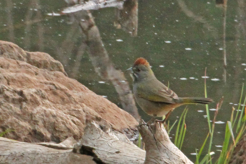
Green-tailed Towhee. AZ: Greenlee County, Apache National Forest, Buffalo Crossing on the Black River.
.jpg)
Lesser Goldfinch. AZ: Greenlee County, Apache National Forest, Buffalo Crossing on the Black River.
.jpg)
MacGillivrays Warbler. AZ: Greenlee County, Apache National Forest, Buffalo Crossing on the Black River.
.jpg)
Song Sparrow. AZ: Greenlee County, Apache National Forest, Buffalo Crossing on the Black River.
.jpg)
Warblering Vireo. AZ: Greenlee County, Apache National Forest, Buffalo Crossing on the Black River.
.jpg)
Wilson's Warbler. AZ: Greenlee County, Apache National Forest, Buffalo Crossing on the Black River.
.jpg)
Pygmy Nuthatch. AZ: Greenlee County, Apache National Forest, Buffalo Crossing on the Black River.
.jpg)
White-crowned Sparrow. AZ: Greenlee County, Apache National Forest, Buffalo Crossing on the Black River.
.jpg)
Least Chipmunk. AZ: Greenlee County, Apache National Forest, Buffalo Crossing on the Black River.
.jpg)
Golden-mantled Ground Squirrel. AZ: Greenlee County, Apache National Forest, Buffalo Crossing on the Black River.
.jpg)
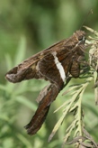
Dainty Sulphur. AZ: Greenlee County, Apache National Forest, Buffalo Crossing on the Black River.
.jpg)
Striped Meadowhawk. AZ: Greenlee County, Apache National Forest, Buffalo Crossing on the Black River.
.jpg)
Mexican Forktail. AZ: Greenlee County, Apache National Forest, Buffalo Crossing on the Black River.
.jpg)
Southwestern Spiny Lizard. AZ: Greenlee County, Apache National Forest, Buffalo Crossing on the Black River.
September 12
We spent the whole day, once again, on the Black River at Buffalo Crossing. It was another cold night, but warmed up quicker today and was not as hazy. Diana and I walked around until 12:30 PM looking at birds mostly. The odes finally started showing up around 1 or 2 PM. More Common Green Darners flying today. I went up stream past the campground to check the stream out. More darners flying in that area.
.jpg)
AZ: Greenlee County, Apache National Forest, Buffalo Crossing on the Black River.
.jpg)
AZ: Greenlee County, Apache National Forest, Buffalo Crossing on the Black River.
.jpg)
Great Blue Heron. AZ: Greenlee County, Apache National Forest, Buffalo Crossing on the Black River.
.jpg)
Yellow-rumped Wabler. AZ: Greenlee County, Apache National Forest, Buffalo Crossing on the Black River.
.jpg)
Brewer's Sparrow. AZ: Greenlee County, Apache National Forest, Buffalo Crossing on the Black River.
.jpg)
House Wren. AZ: Greenlee County, Apache National Forest, Buffalo Crossing on the Black River.
.jpg)
Lincoln's Sparrow. AZ: Greenlee County, Apache National Forest, Buffalo Crossing on the Black River.
.jpg)
Townsend's Warbler. AZ: Greenlee County, Apache National Forest, Buffalo Crossing on the Black River.
.jpg)
Townsend's Warbler. AZ: Greenlee County, Apache National Forest, Buffalo Crossing on the Black River.
.jpg)
Melissa Hairstreak. AZ: Greenlee County, Apache National Forest, Buffalo Crossing on the Black River.
.jpg)
Arizona Sister. AZ: Greenlee County, Apache National Forest, Buffalo Crossing on the Black River.
.jpg)
Mylitta Checkerspot. AZ: Greenlee County, Apache National Forest, Buffalo Crossing on the Black River.
.jpg)
AZ: Greenlee County, Apache National Forest, Buffalo Crossing on the Black River.
.jpg)
Geranium. AZ: Greenlee County, Apache National Forest, Buffalo Crossing on the Black River.
.jpg)
Daisy. AZ: Greenlee County, Apache National Forest, Buffalo Crossing on the Black River.
.jpg)
Larkspur. AZ: Greenlee County, Apache National Forest, Buffalo Crossing on the Black River.
.jpg)
Mexican Forktail. AZ: Greenlee County, Apache National Forest, Buffalo Crossing on the Black River.
.jpg)
Striped Meadowhawk. AZ: Greenlee County, Apache National Forest, Buffalo Crossing on the Black River.
.jpg)
Common Green Darner. AZ: Greenlee County, Apache National Forest, Buffalo Crossing on the Black River.
.jpg)
Paddle-tailed Darner. AZ: Greenlee County, Apache National Forest, Buffalo Crossing on the Black River.
.jpg)
Paddle-tailed Darner. AZ: Greenlee County, Apache National Forest, Buffalo Crossing on the Black River.
February 13
We broke camp and left at 9 AM and headed for Eagar and Show Low to Walmart then over to Haigler Creek campground. We got some groceries and a new truck battery. Stopped at Sportsman Warehouse to purchase a Tonoto National Forest visitors pass. We got lunch at Kentucky Fried Chicken. We found the city park, ate lunch and had brief service of gospel songs, prayer, communion, scripture reading. We stopped briefly at a lake to check out the birds and then on to Woods Canyon Lake. The campgrounds were nice but very crowded, so we went on. Looked at overlook along rim road going out of Woods Canyon. Our night was spent at Sharp Creek Campground. Nice place and not crowded. Also had cell service so that Diana could talk to everyone at home.
.jpg)
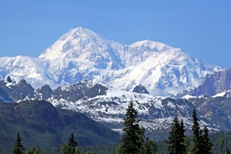
AZ: Coconino County, North of US 260 on Rim Road overlook.
.jpg)
AZ: Coconino County, North of US 260 on Rim Road overlook.
.jpg)
AZ: Coconino County, North of US 260 on Rim Road overlook.

AZ: Coconino County, North of US 260 on Rim Road overlook.
February 14
I took a few photos of Sharp Creek campground before heading to Payson for gas, post office, and Ranger Station (closed). We then headed for Hagler Creek campground. The road was steep downhill drive to canyon and very rough rug board road. We got to creek and campground between 10:30 and 11 AM and set up camp. We were the only ones there except for a couple of workers who we never saw. The creek looked good but there was lots of tree coverage that blocked the sun. I looked around for a couple of hours, but only found few odes.
.jpg)
AZ: Gila County, Sharp Creek campground.
.jpg)
AZ: Gila County, Sharp Creek campground.
.jpg)
AZ: Gila County, Tonto National Forest, Haigler Creek campground.
.jpg)
AZ: Gila County, Tonto National Forest, Haigler Creek campground.
.jpg)
Tonto Dancer. AZ: Gila County, Tonto National Forest, Haigler Creek campground.
.jpg)
Canyon Rubspot. AZ: Gila County, Tonto National Forest, Haigler Creek campground.
.jpg)
Springwater Dancer. AZ: Gila County, Tonto National Forest, Haigler Creek campground.
.jpg)
Springwater Dancer. AZ: Gila County, Tonto National Forest, Haigler Creek campground.
.jpg)
Sooty Dancer. AZ: Gila County, Tonto National Forest, Haigler Creek campground.
.jpg)
Great Spreadwing. AZ: Gila County, Tonto National Forest, Haigler Creek campground.
.jpg)
Mormon Checkerspot. AZ: Gila County, Tonto National Forest, Haigler Creek campground.
.jpg)
Western Red-bellied Tiger Beetle. AZ: Gila County, Tonto National Forest, Haigler Creek campground.
.jpg)
Hutton's Vireo. AZ: Gila County, Tonto National Forest, Haigler Creek campground.
.jpg)
Mexican Jay. AZ: Gila County, Tonto National Forest, Haigler Creek campground.
September 15
Before we broke camp I photographed a beetle that had flown into the light. We didn't head south until about 9 AM. This route was not as rough, but it took longer to get out of the Young Valley. We stopped at Workman Creek on the way out to check if any Arizona Spiketails were flying. None where observed. We ate lunch in Payson and washed clothes before heading to Camp Verde to get a motel room. Stayed at Copper Canyon Motel. Nice and not too expensive.
.jpg)
Glorious Beetle. AZ: Gila County, Tonto National Forest, Haigler Creek campground.
.jpg)
AZ: Gila County, Road from Young to Roosevelt.
.jpg)
AZ: Gila County, Road from Young to Roosevelt. Looking back to Young,
.jpg)
AZ: Gila County, Road from Young to Roosevelt.
.jpg)
Tonto Dancer. AZ: Gila County, Tonto National Forest, Workman Creek.
.jpg)
Hutton's Vireo. AZ: Gila County, Tonto National Forest, Workman Creek.
.jpg)
Bridled Titmouse. AZ: Gila County, Tonto National Forest, Workman Creek.
.jpg)
AZ: Gila County, Road from Young to Roosevelt. Leaving the mountains before getting to Roosevelt.
.jpg)
AZ: Gila County, Road from Young to Roosevelt. Leaving the mountains before getting to Roosevelt.
September 16
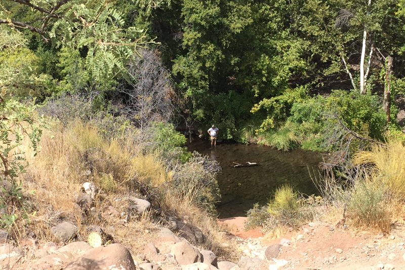
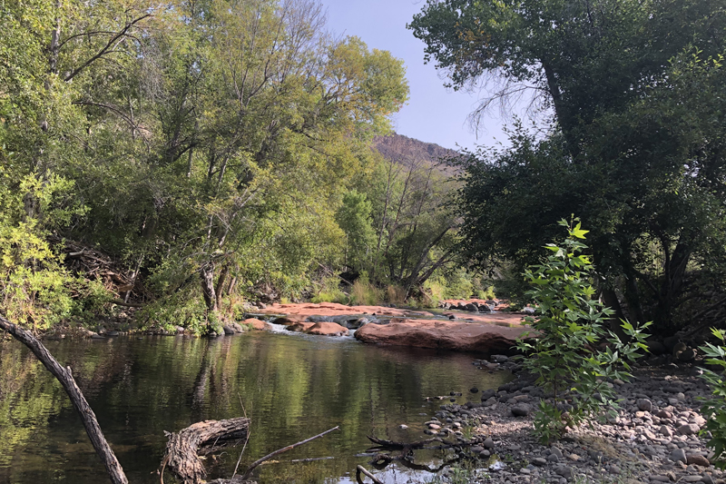
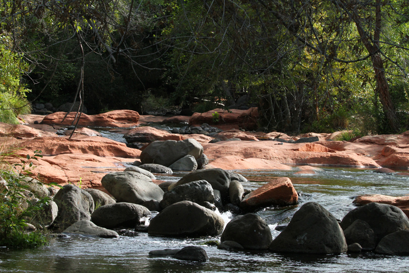
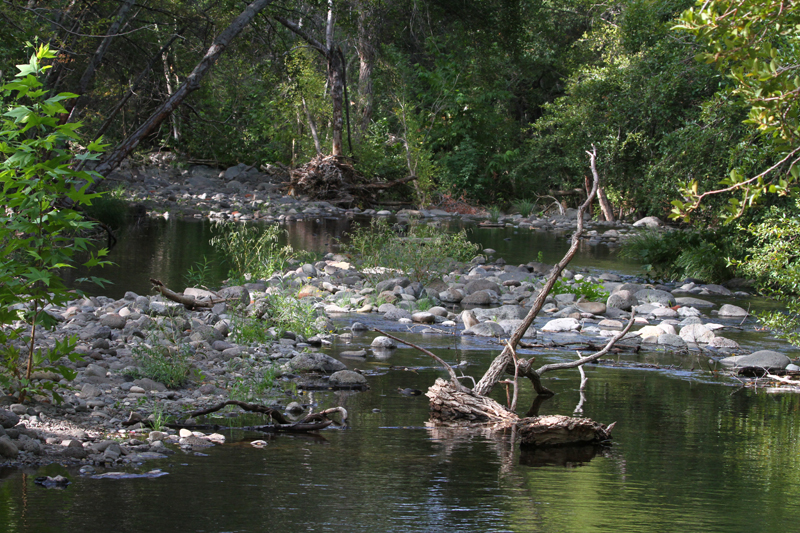
Got up from the motel at 7 AM and then stopped at McDonald's to eat breakfast before heading north to Wet Beaver Creek Recreation Area. We got there around 8:30 AM which was actually too early. Still cool. I searched all morning up and down the creek with some success with damselflies but very few dragonflies. The stream was difficult to walk due to the rocks being very slippery.
AZ: Coconino County, Wet Beaver Creek Recreation Area.
AZ: Coconino County, Wet Beaver Creek Recreation Area.
AZ: Coconino County, Wet Beaver Creek Recreation Area.
AZ: Coconino County, Wet Beaver Creek Recreation Area.
.jpg)
Great Spreadwing. AZ: Coconino County, Wet Beaver Creek Recreation Area.
.jpg)
Lavender Dancer. AZ: Coconino County, Wet Beaver Creek Recreation Area.
.jpg)
Sooty Dancer. AZ: Coconino County, Wet Beaver Creek Recreation Area.
.jpg)
Aztec Dancer. AZ: Coconino County, Wet Beaver Creek Recreation Area.
.jpg)
Firey-eyed Dancer. AZ: Coconino County, Wet Beaver Creek Recreation Area.
.jpg)
Pima Dancer. AZ: Coconino County, Wet Beaver Creek Recreation Area.
.jpg)
Springwater Dancer. AZ: Coconino County, Wet Beaver Creek Recreation Area.
.jpg)
Blue-ringed Dancer. AZ: Coconino County, Wet Beaver Creek Recreation Area.
![]()
Dusky Dancer. AZ: Coconino County, Wet Beaver Creek Recreation Area.
.jpg)
American Rubspot. AZ: Coconino County, Wet Beaver Creek Recreation Area.
.jpg)
Canyon Rubyspot. AZ: Coconino County, Wet Beaver Creek Recreation Area.
.jpg)
Mexican Forktail. AZ: Coconino County, Wet Beaver Creek Recreation Area.
.jpg)
Arroyo Bluet. AZ: Coconino County, Wet Beaver Creek Recreation Area.
.jpg)
Serpent Ringtail. AZ: Coconino County, Wet Beaver Creek Recreation Area.
.jpg)
Red Rock Skimmer. AZ: Coconino County, Wet Beaver Creek Recreation Area.
.jpg)
Greater Earless Lizard. AZ: Coconino County, Wet Beaver Creek Recreation Area.
.jpg)
Ornate Tree Lizard. AZ: Coconino County, Wet Beaver Creek Recreation Area.
.jpg)
Plumbeous Vireo. AZ: Coconino County, Wet Beaver Creek Recreation Area.
.jpg)
Two-tailed Swallowtail. AZ: Coconino County, Wet Beaver Creek Recreation Area.
We left Wet Beaver Canyon and headed for Yuma. Drove through Jerome on the way. Interesting town!
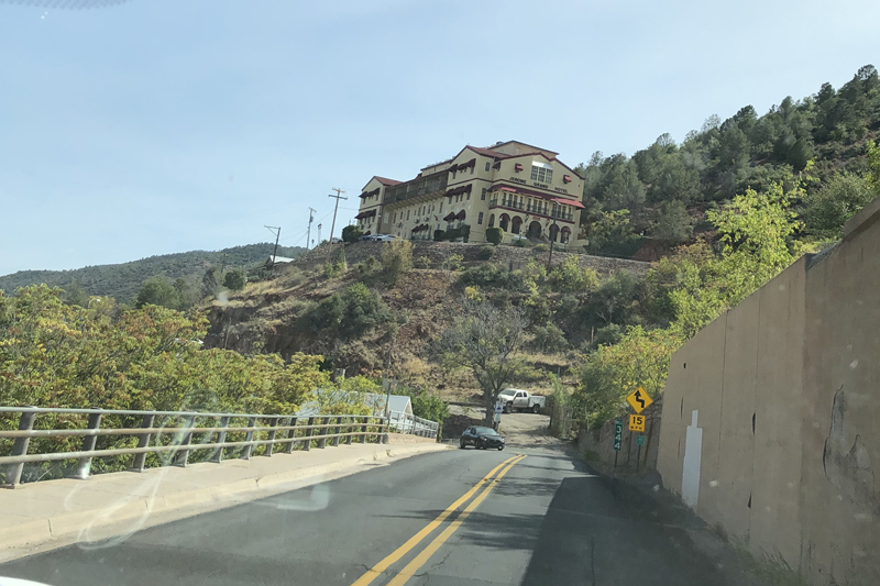
AZ: Jerome old mining town.
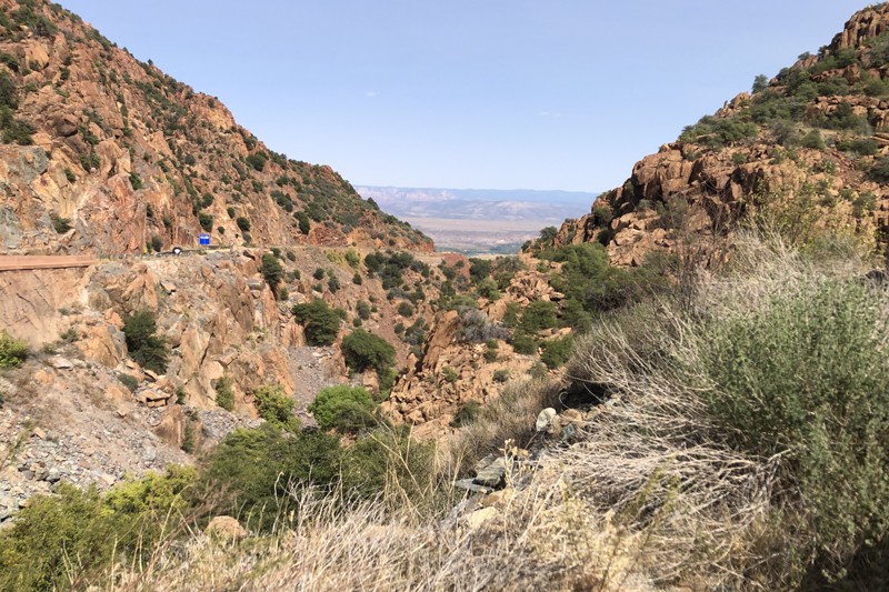
AZ: Jerome old mining town pass above town.
We got to Yuma after dark and finally got a motel after 3 attempts. It was only 110 degrees in Yuma when we got there (around 10:00 PM).
September 17
We had a good night sleep. Ate breakfast at McDonald's again and then headed for Yuma Prison State Historical Park and then over to Colorado River State Park. Back in the 1870's the town people thought that the prisoners had more advantages than the town's citizens since the Warden wanted the prisoners to be able to read and write when they got out. That way the former prisoners could succeed and not go back to the behavior that got them sent to prison.
We looked at the exhibits, etc. I did go down to the river briefly to see what was flying down there. There were lots of lizards (Uta) around the building and river walk area. It was getting really hot so we headed east by noon.
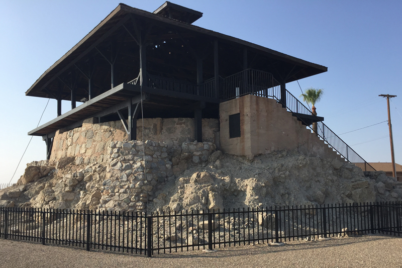
Yuma Prison State Historic Park
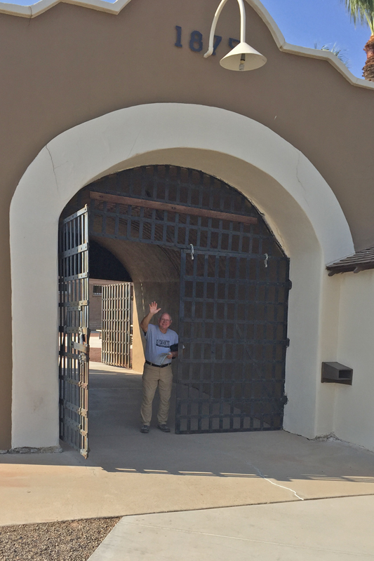
Yuma Prison State Historic Park
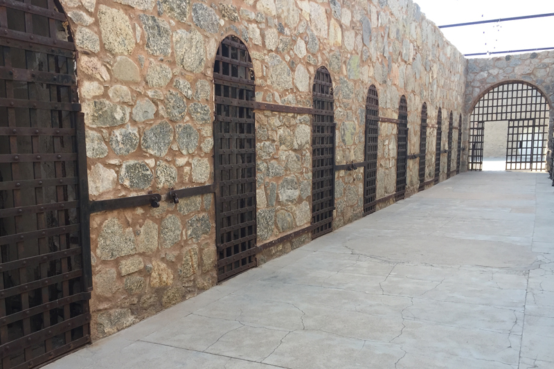
Yuma Prison State Historic Park
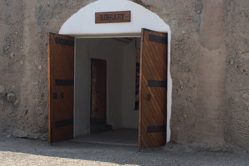
Yuma Prison State Historic Park
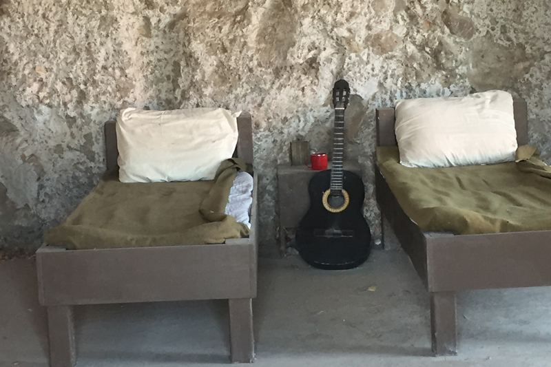
Yuma Prison State Historic Park
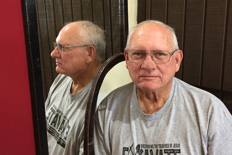
Could take one picture and get both profile and face shot at the same time. Yuma Prison State Historic Park
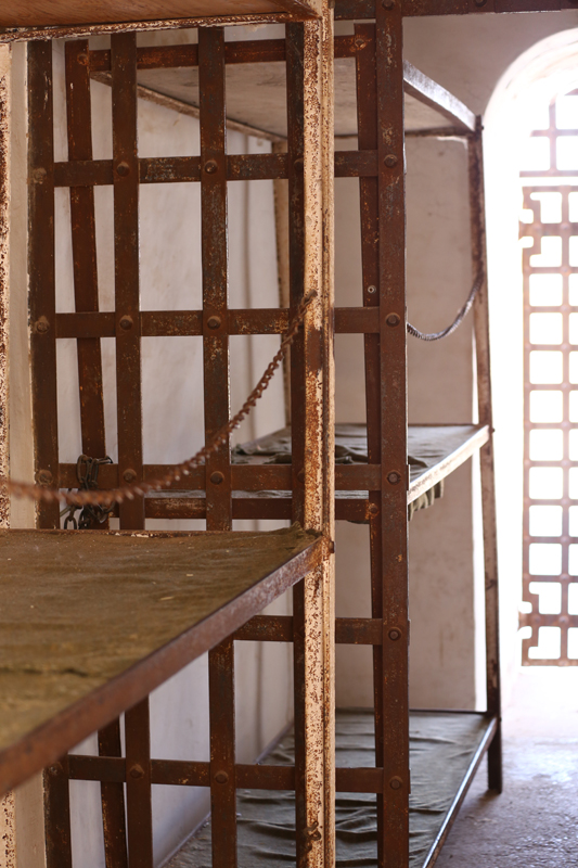
Yuma Prison State Historic Park
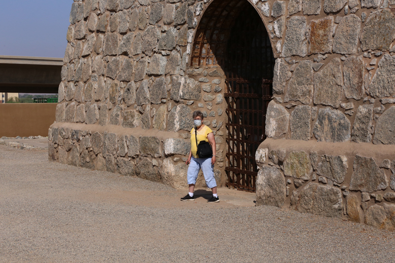
Yuma Prison State Historic Park
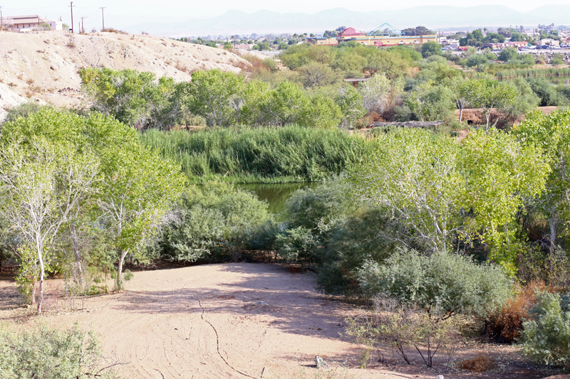
Colorado River trails
.jpg)
Blue-ringed Dancer. Colorado River trails
.jpg)
American Rubyspot. Colorado River trails
.jpg)
Familiar Bluet. Colorado River trails
.jpg)
Powdered Dancer. Colorado River trails
.jpg)
Side-blotched Lizard. Colorado River State Park
.jpg)
Vermilion Flycatcher. Colorado River State Park
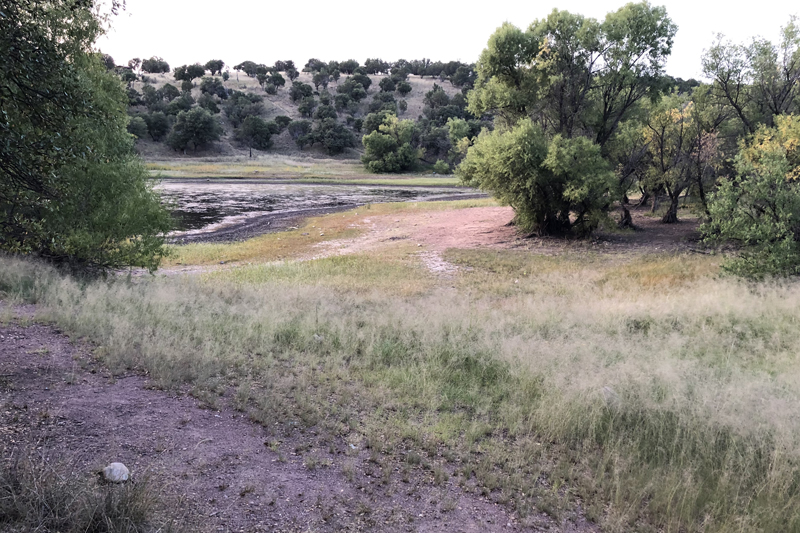
We arrived at Parker Lake Recreation Area campground between 5:30 and 6 PM. Parker Lake was the lowest I have ever seen it. We did see a few things before dark. NICE COOL NIGHT!
.jpg)
Pronghorn. AZ: Cochise County, Parker Lake Road.
AZ: Cochise County, Parker Lake Recreation Area
.jpg)

Lazuli Bunting. AZ: Cochise County, Parker Lake Recreation Area and Chipping Sparrow. AZ: Cochise County, Parker Lake Recreation Area
September 18
No big hurry to get up this morning. We were waiting for it to warm up enough to check out Bear Creek Canyon on the way east out of the mountains. A couple of lizards and a bird were seen before we left.
.jpg)
Gray Flycatcher. AZ: Cochise County, Parker Lake Recreation Area
.jpg)
Tree Lizard. AZ: Cochise County, Parker Lake Recreation Area
.jpg)
Earless Lizard. AZ: Cochise County, Parker Lake Recreation Area
Bear Creek 9:30 - 11:30 AM. The water was barely flowing and livestock had damaged the vegetation and eaten most of the grasses along the stream and had trampled the marshy areas. It was in bad shape. I still was able to observe a few critters especially some giant skippers.
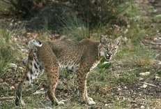
AZ: Cochise County, Huachuca Mountains, Bear Creek
AZ: Cochise County, Huachuca Mountains, Bear Creek
.jpg)
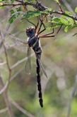
Flame Skimmer. AZ: Cochise County, Huachuca Mountains, Bear Creek
.jpg)
American Rubyspot. AZ: Cochise County, Huachuca Mountains, Bear Creek
.jpg)
Springwater Dancer. AZ: Cochise County, Huachuca Mountains, Bear Creek
.jpg)
Cardinal Meadowhawk. AZ: Cochise County, Huachuca Mountains, Bear Creek
.jpg)
Aztec Dancer. AZ: Cochise County, Huachuca Mountains, Bear Creek
.jpg)
Lavender Dancer. AZ: Cochise County, Huachuca Mountains, Bear Creek
.jpg)
Tonto Dancer. AZ: Cochise County, Huachuca Mountains, Bear Creek
.jpg)
Spine-tipped Dancer. AZ: Cochise County, Huachuca Mountains, Bear Creek
.jpg)
Great Spreadwing. AZ: Cochise County, Huachuca Mountains, Bear Creek
.jpg)
Mexican Forktail. AZ: Cochise County, Huachuca Mountains, Bear Creek
.jpg)
Giant Skipper. AZ: Cochise County, Huachuca Mountains, Bear Creek
.jpg)
Giant Skipper. AZ: Cochise County, Huachuca Mountains, Bear Creek
.jpg)
Arizona Metalmark. AZ: Cochise County, Huachuca Mountains, Bear Creek
.jpg)
Northern Waterthrush. AZ: Cochise County, Huachuca Mountains, Bear Creek
.jpg)
Northern Waterthrush. AZ: Cochise County, Huachuca Mountains, Bear Creek
.jpg)
Wilson's Warbler. AZ: Cochise County, Huachuca Mountains, Bear Creek
.jpg)
Mexican Jay. AZ: Cochise County, Huachuca Mountains, Bear Creek
.jpg)
Sonoran Spotted Whiptail. AZ: Cochise County, Huachuca Mountains, Bear Creek
AZ: Cochise County, Huachuca Mountains, from Montazuma Pass
Before leaving the Huachuca Mountains, we stopped at Beatties B&B to look at their Hummingbirds at the feeders. This is in the back end of Miller Canyon on the east side of the mountains. Several species were observed and we were the only individuals there.
.jpg)
White-tailed Deer. AZ: Cochise County, Miller Canyon, Beatties B&B hummingbird feeders.
.jpg)
Anna'a Hummingbird? AZ: Cochise County, Miller Canyon, Beatties B&B hummingbird feeders.
.jpg)
Broad-tailed Hummingbird? AZ: Cochise County, Miller Canyon, Beatties B&B hummingbird feeders.
.jpg)
Rivali's Hummingbird. AZ: Cochise County, Miller Canyon, Beatties B&B hummingbird feeders.
.jpg)
Broad-billed Hummingbird. AZ: Cochise County, Miller Canyon, Beatties B&B hummingbird feeders.
.jpg)
Rivoli's Hummingbird. AZ: Cochise County, Miller Canyon, Beatties B&B hummingbird feeders.
.jpg)
Rufous Hummingbird. maybe Allens. AZ: Cochise County, Miller Canyon, Beatties B&B hummingbird feeders.
.jpg)
White-eared Hummingbird. AZ: Cochise County, Miller Canyon, Beatties B&B hummingbird feeders.
.jpg)
White-eared Hummingbird. AZ: Cochise County, Miller Canyon, Beatties B&B hummingbird feeders.
After eating in town, we headed for Douglas, got gas and a few things and headed up to Cave Creek Canyon in the Chiricahua Mountains. All of the campgrounds were closed, so we went up the road beyond the no camping and shooting zone and parked at a pull out. We were going to see if we could find the Eared Quetzal. There were still many birders hanging around the area wHere the bird had been seen.
September 19
After eating breakfast we headed down to the area were the Quetzal has been observed. We heard it several times, but never got a look at it. After 3 hours of not seeing it, we decided to go out to a couple of areas for water along the creek for odes. We went up Dan Morter Road and up South Fork Road. Not much water anywhere. We decided to go into Rodeo to the Chiricahua Desert Museum and check it out. We ate at Sky Island Grill and got some groceries. We got back to the Quetzal area at 3 PM and it was there. It stayed around until at least 5 PM. The male moved around some but the female stayed in one place. Diana and I decided to camp once again up the road at a hunter's pull out.

AZ: Cochise County, Chiricahua Mountains. Entance to Cave Creek Canyon near Portal.
.jpg)
Turkey. AZ: Cochise County, Chiricahua Mountains, Cave Creek Canyon.
.jpg)
Canyon Wren. AZ: Cochise County, Chiricahua Mountains, Cave Creek Canyon.
.jpg)
Plumbeous Vireo. AZ: Cochise County, Chiricahua Mountains, Cave Creek Canyon.
.jpg)
Western Tanager. AZ: Cochise County, Chiricahua Mountains, Cave Creek Canyon.
.jpg)
Eared Quetzal. AZ: Cochise County, Chiricahua Mountains, Cave Creek Canyon.
.jpg)
Eared Quetzal. AZ: Cochise County, Chiricahua Mountains, Cave Creek Canyon.
.jpg)
Chiricahua Fox Squirrel. AZ: Cochise County, Chiricahua Mountains, Cave Creek Canyon.
.jpg)
Yarrow's Spiny Lizard. AZ: Cochise County, Chiricahua Mountains, Cave Creek Canyon.
.jpg)
Yarrow's Spiny Lizard. AZ: Cochise County, Chiricahua Mountains, Cave Creek Canyon.
.jpg)
Tonto Dancer. AZ: Cochise County, Chiricahua Mountains, Cave Creek Canyon.
\.jpg)
Sooty Dancer. AZ: Cochise County, Chiricahua Mountains, Cave Creek Canyon.
.jpg)
Canyon Rubyspot. AZ: Cochise County, Chiricahua Mountains, Cave Creek Canyon.
.jpg)
Flame Skimmer. NM: Hidalgo County, Rodeo Chiricahua Desert Museum.

Aztec Dancer. NM: Hidalgo County, Rodeo Chiricahua Desert Museum.
.jpg)
Red-spotted Purple. AZ: Cochise County, Chiricahua Mountains, Cave Creek Canyon.
September 20
We left the Chiricahua Mountains at 8 AM and arrived in El Paso about 11 AM MST. Stopped at Vinton Road and Rio Grande again. Not much flying again. Arrived at Davis Mountains State Park at 7:30 PM. We called in early and made sure there was spot for us. On the way to the park on TX 118, we found a Bullsnake and a Black-tailed Rattlesnake.
.jpg)
Blue-ringed Dancer. TX: El Paso County, Vinton Road at the Rio Grande.
.jpg)
Says Phoebe TX: El Paso County, Vinton Road at the Rio Grande.
.jpg)
Blacktail Rattlesnake. TX: Jeff Davis County, State 118.

Bullsnake. TX: Jeff Davis County, State 118.
.jpg)
Ladder-backed Woodpecker. TX: Jeff Davis County, Davis Mountains State Park.
.jpg)
Rufous Hummingbird. TX: Jeff Davis County, Davis Mountains State Park.
.jpg)
Tarantula. TX: Jeff Davis County, Davis Mountains State Park.
September 21
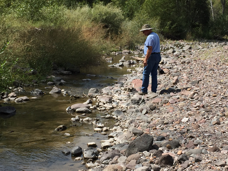
It was a nice cool morning at the Park this morning. Nice sleeping. On the way home, we stopped at Sandia Springs Wetlands (Nature Conservancy) east of Balmorhea to check for odes. Very little water present. There were some in canal and dragonfly pond. I didn't realize that most of the wetland was on the east side of the road. When I checked that area out, I started finding a few odes.
.jpg)
Rambur's Forktail TX: Reeves County, Sandia Springs Wetlands (Nature Conservancy) east of Balmorhea.
.jpg)
Blue-ringed Dancer. TX: Reeves County, Sandia Springs Wetlands (Nature Conservancy) east of Balmorhea.
.jpg)
American Rubyspot. TX: Reeves County, Sandia Springs Wetlands (Nature Conservancy) east of Balmorhea.
.jpg)
Desert Firetail. TX: Reeves County, Sandia Springs Wetlands (Nature Conservancy) east of Balmorhea.
.jpg)
Familiar Bluet. TX: Reeves County, Sandia Springs Wetlands (Nature Conservancy) east of Balmorhea.
.jpg)
Kiowa Dancer. TX: Reeves County, Sandia Springs Wetlands (Nature Conservancy) east of Balmorhea.
.jpg)
Aztec Dancer. TX: Reeves County, Sandia Springs Wetlands (Nature Conservancy) east of Balmorhea.
.jpg)
Black-fronted Forktail. TX: Reeves County, Sandia Springs Wetlands (Nature Conservancy) east of Balmorhea.
.jpg)
Western Pondhawk. TX: Reeves County, Sandia Springs Wetlands (Nature Conservancy) east of Balmorhea.
.jpg)
Twelve-spoted Skimmer. TX: Reeves County, Sandia Springs Wetlands (Nature Conservancy) east of Balmorhea.
.jpg)
Comanche Skimmer. TX: Reeves County, Sandia Springs Wetlands (Nature Conservancy) east of Balmorhea.
.jpg)
Citrine Forktail. TX: Reeves County, Sandia Springs Wetlands (Nature Conservancy) east of Balmorhea.
.jpg)
Variegated Meadowhawk. TX: Reeves County, Sandia Springs Wetlands (Nature Conservancy) east of Balmorhea.
.jpg)
Paiute Dancer. TX: Reeves County, Sandi Springs Wetlands (Nature Conservancy) east of Balmorhea.
From here we headed for home. We got home between 7:30 and 8:00 PM.